Turn what's in your way into what sets you apart.
Multimodal AI - Actionable Intelligence.
Thetaspace builds AI that fuses multi-source data into real-time value

Multimodal AI
Integrate diverse data modalities into one intelligent pipeline
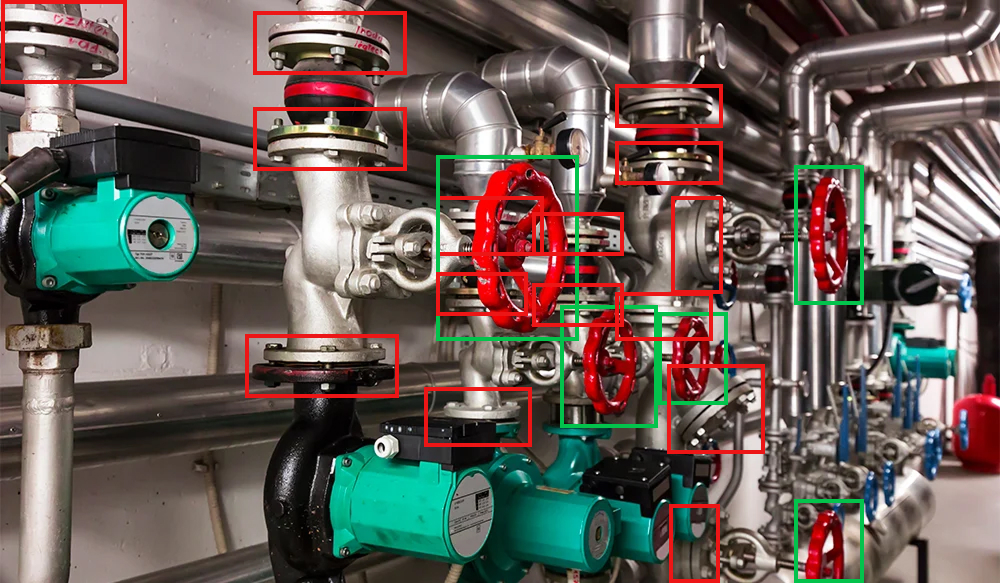
Fuse Data Streams
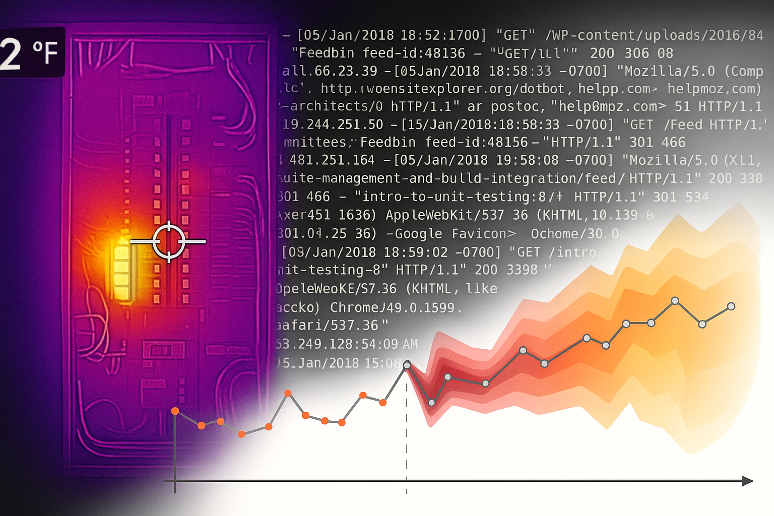
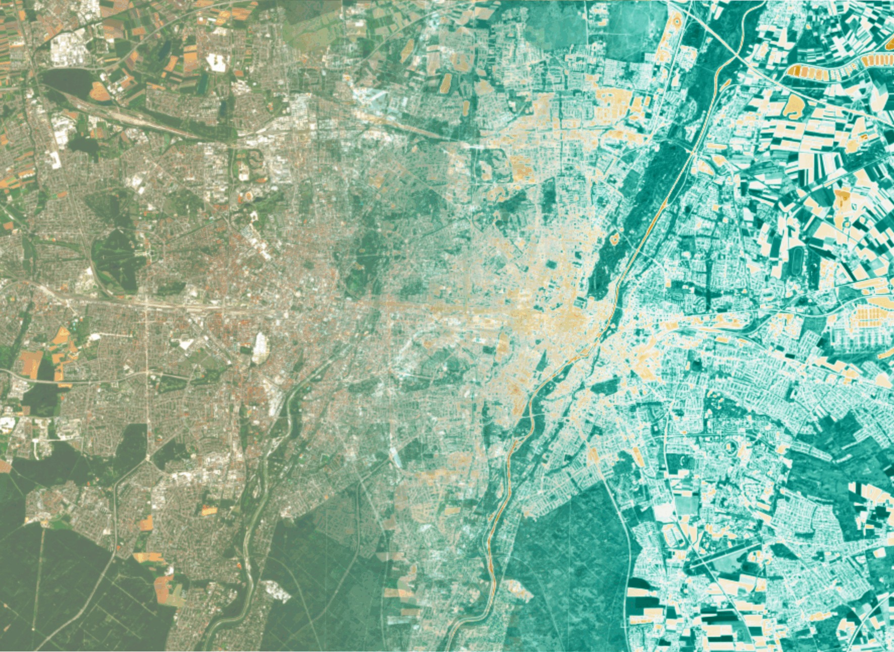
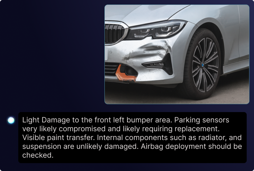
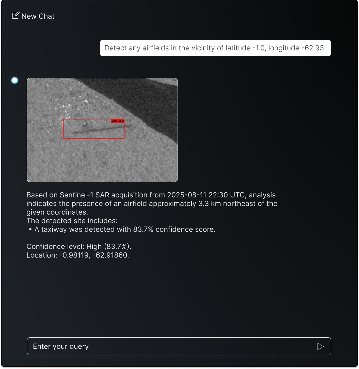
Combine data of different nature from diverse sensors, whether text, image, satellite, or IoT, to create a unified understanding of complex environments.
Complete the Picture
Each data source carries only part of the story. By fusing them, gaps are filled and more accurate perspective emerges, enabling decisions based on the full spectrum of available information.
Enterprise AI
From concept architecture to live optimization, we build AI solutions engineered for enterprise scale and your exact specifications.
AI AS PART OF YOUR POLICY
Use AI to interpret and apply policies with speed, consistency, and accuracy. Decisions you can trust
AI AS PART OF YOUR STRATEGY
Harness breakthrough intelligence to anticipate challenges and stay ahead of the competition
AI AS PART OF YOUR OPERATIONS
Empower your business with real-time awareness, and faster response to change
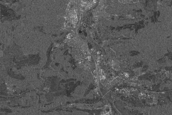
Intelligence & Remote Sensing
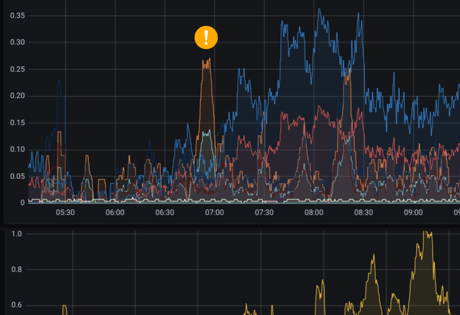
Real-Time Intelligence on demand
Expertise