Satellite & Aerial Data Analysis
High-resolution satellite and aerial data analysis for geospatial insights, environmental monitoring, and strategic intelligence applications.
Remote Sensing Capabilities
Advanced analysis of satellite and aerial imagery for comprehensive Earth observation and monitoring.
Satellite Imagery Analysis
Multi-spectral and hyperspectral satellite data processing for detailed Earth observation.
Change Detection
Temporal analysis to identify and quantify changes in land use, vegetation, and infrastructure.
Land Cover Classification
Automated classification of terrain, vegetation, water bodies, and urban areas.
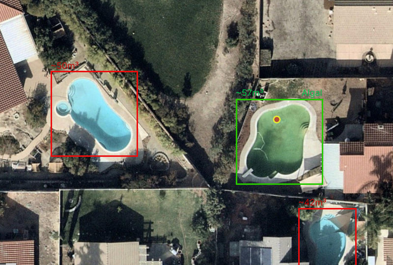
Object Recognition
Detection and identification of vehicles, buildings, ships, and other objects from above.
Environmental Monitoring
Track deforestation, urban growth, agricultural patterns, and climate impacts.
Real-Time Processing
Near real-time analysis of incoming satellite feeds for rapid response applications.
Real-world Applications
Remote sensing solutions deployed across government, commercial, and research sectors.
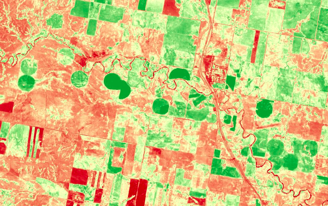
Agricultural Intelligence
Crop monitoring, yield prediction, and precision agriculture using multi-spectral satellite data.
Generative Geospatial AI
Synthesize and enhance satellite imagery. Cloud removal, super-resolution, and scenario simulation to fill data gaps and boost model performance.
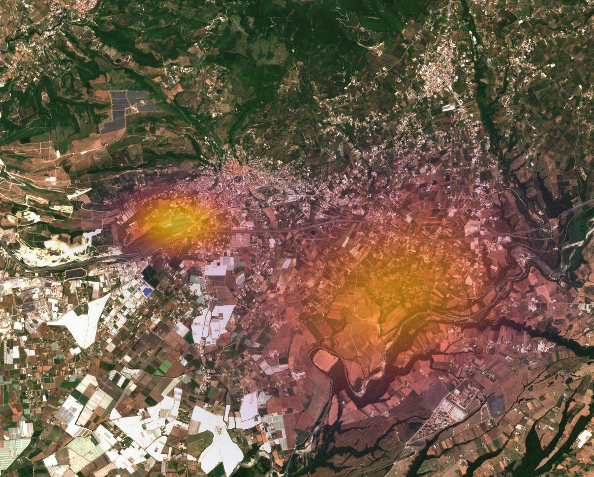
Business Insights from Earth Observation
Satellite imagery translated into actionable market intelligence—empowering businesses to understand activity, demand, and opportunities with a new layer of clarity.
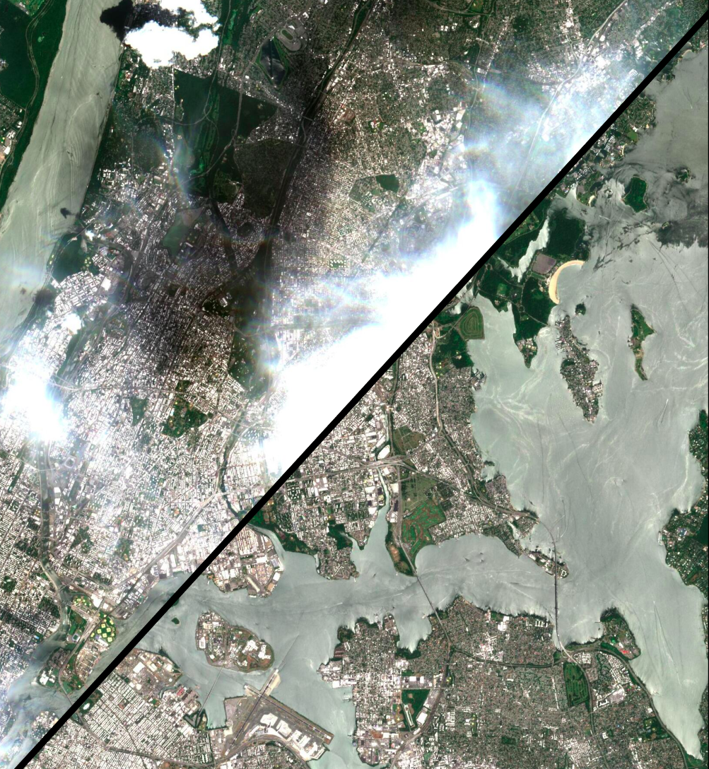
Disaster Response & Management
Rapid damage assessment and emergency response coordination using near real-time satellite imagery.
Satellite Data Sources
We work with data from leading satellite constellations and aerial platforms worldwide.
Landsat
Long-term Earth observation with 30m resolution
30m resolution, 16-day revisit
Sentinel
European Space Agency's Copernicus program
up to 10m resolution, 5-day revisit
Planet
Daily global imagery with high resolution
up to 3m resolution, daily coverage
Maxar
Commercial high-resolution satellite imagery
up to 30cm resolution, on-demand
See Earth from a New Perspective
Unlock the power of satellite and aerial data for your organization's strategic advantage.